Over the last few decades, Songkhla has been rapidly developed and is currently a unique attractionworth visiting. Blessed with natural resources, such as fine beaches, enchanting waterfalls, and a tranquil Lake, the province has an abundance of tourist attractions and an amazing number of seaside resort towns. Moreover, the old section of Songkhla still maintains its unique identity of ancient and Historical flavours through Local architecture and CUISINE.
An undeniably historic town endowed with ancient ruins and places of cultural importance, Songkhlais a melting pot of Thais, Chinese and Malays, and charms visitors with its unique traditions, dialect, and folk entertainment. These characteristics are reflections of the province’s rich cultural heritage, which has been preserved and passed down from generation to generation.
Songkla Old Town
Has three important roads: nakhon Nok, Nakhon Nai, and Nang Ngam Roads, which are full of buildings with beautiful architecture and the original identity of old buildings in the Sino-Portuguese style and commercial Chinese shophouses.
The starting point for a walk around the Old Town Songkhla is from the Songkhla City Gate along nakhon Nok Road, which is a road along the Songkhla Lake. At the end of the road is an old mill painted red called “Hap Ho Hin”, which now arranges permanent exhibitions. The story of the Old Town Songkhla continues on Nakhon Nai and Nang Ngam Roads, which have a collection of local savoury restaurants that have been famous for decades. Shops that sell Thai desserts are hard to find, e.g., Khi Mot, Thong Ek, Khao Fang Kuan, Khanom Krabok. Khanom Butu, Sampanni, as well as an ice cream shop, rice and stew shop, ancient coffee shop, etc.
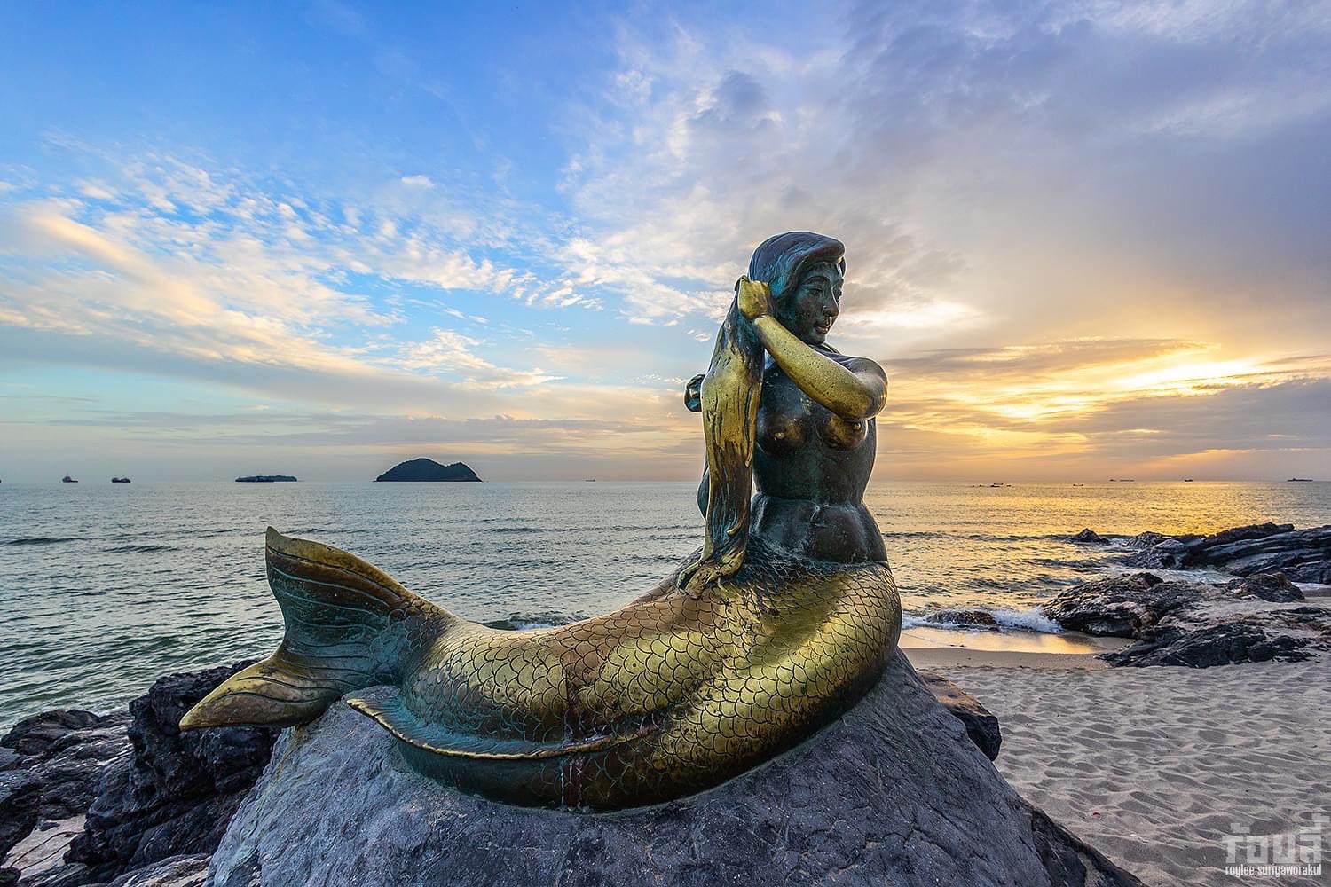
Laem Samila
On the beach, there is a statue of a mermaid sitting on a rock called “Ngueak Thong”, which is the symbol of this beach. Not far from the mermaid statue is a cat and rat statue, which tells the legend of ko Nu and Ko Maeo, the islands that can be clearly seen from Hat Samila Beach.
“Anyone who has visited Songkhla and has not visited Samila, has not arrived in Songkhla.”
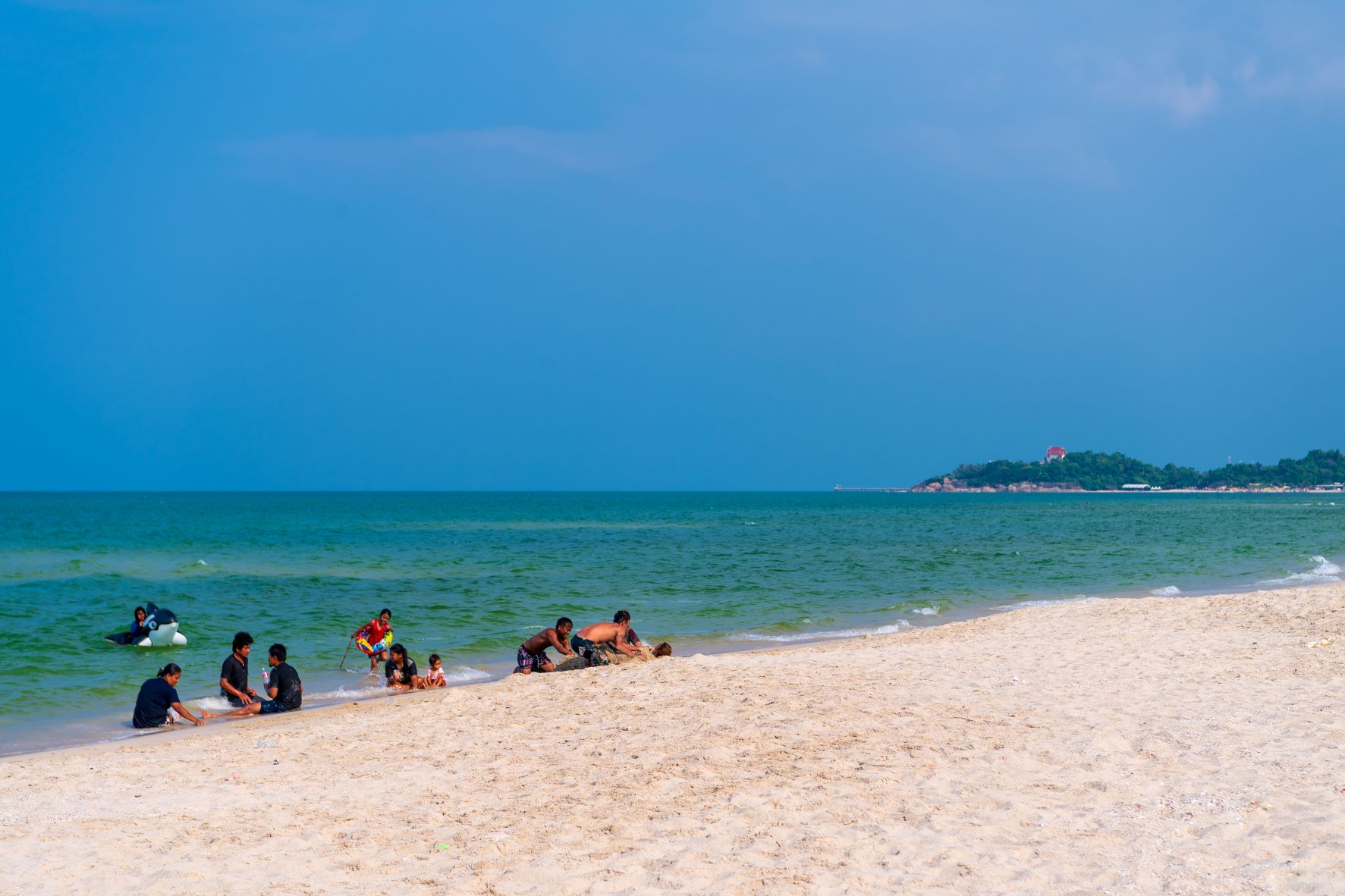
Chalatat Beach
A long Beach that continues from Hat Samila with Laem Samila as a dividing point. It has a clean white sandy beach, and it is possible to swim here. Chalatat Road is shady with pine trees along the beach. At the northern end of the beach connecting Laem Samila, there is a roundabout with sculptures of people reading that was created for the Thai people to love reading.
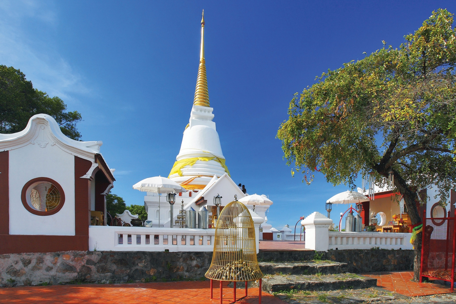
Khao Tang Kuan
A hill that is about 105 metres above sea level. On the top of the hill is enshrined the Phrathat Chedi of Songkhla The pavilion faces one side of Khao Tangkuan, and it is possible to see the panoramic scenery. From this area, it is possible to see the surrounding scenery 360 degrees, including Songkhla City, Songkhla Lake, Gulf of Thailand, Laem Son On, and Hat Samila. There are two ways to ascend Khao Tangkuan: Walk up the stairs of 145 steps, which is located in the foothills on the other side. Along the way, there are breakpoints and viewpoints from time to time. Alternatively, use the elevator, which is in the area of ?? the road that cuts between Khao Tangkuan and Khao Noi. The fee is 30 Baht. It is open daily 08.30-18.00 Hrs. For more information, Tel. 0 7431 6330
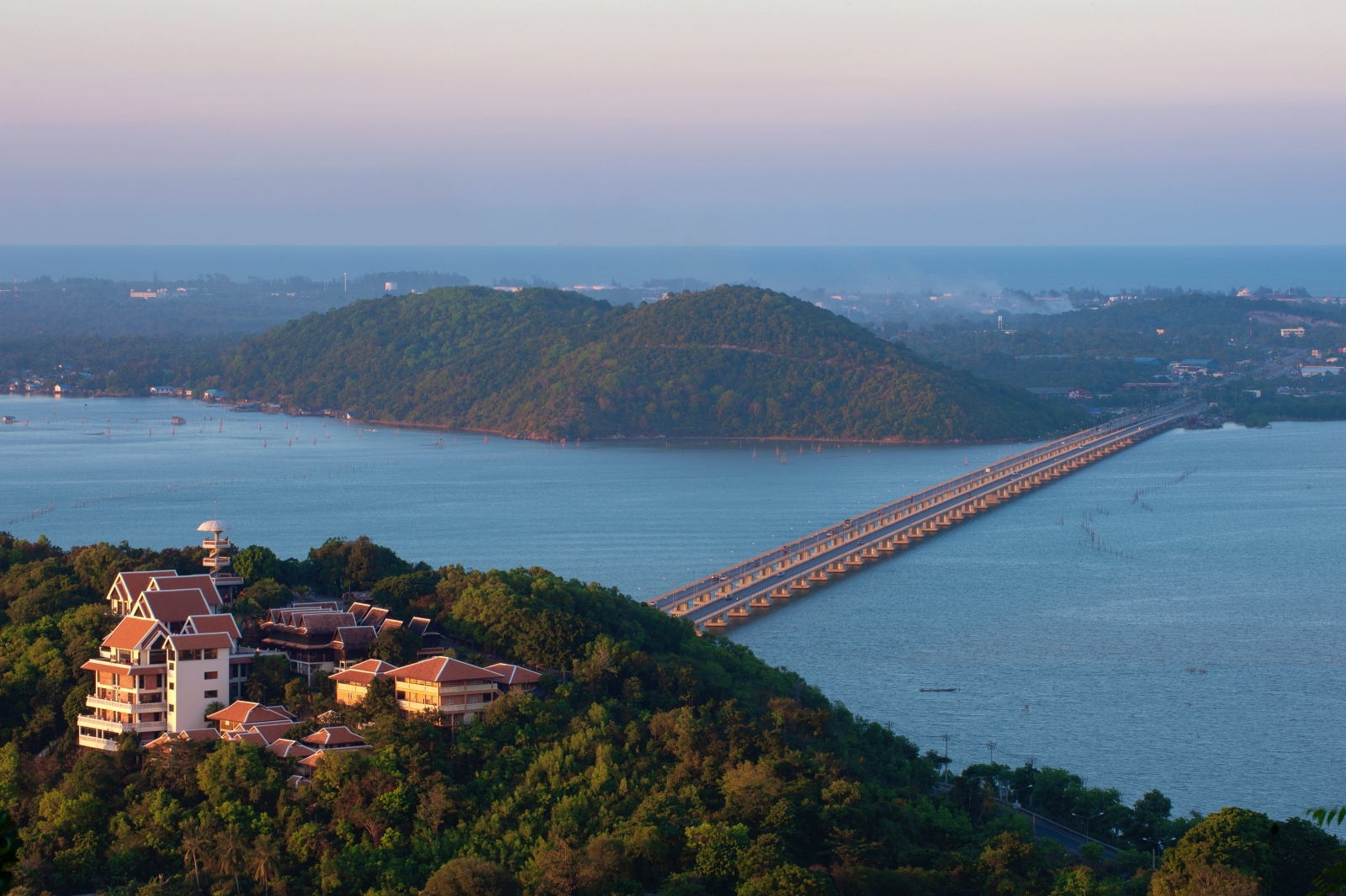
Tinsulanond Bridge
Constructed during the period that General Prem Tinsulanonda was Prime Minister of Thailand. The Local people call it “Tin Bridge” or “Pa Prem’s Bridge”. Construction was begun on 26 March 1984 and the opening ceremony was held on 25 September 1986.
The bridge is divided into two sections. The first section have a distance of 940 metres. The second section have a distance of 1,700 metres. The two sections of the Bridge have a total length of 2,640 metres.
Songkhla Lake
The only natural Lake in Thailand. It receives water from the Banthat mountainRange and Sankalakhiri Mountain Range and is the point where many canals converge together before flowing into the Gulf of Thailand. The length from the estuary to the north is about 80 kilometres, and the widest part is about 20-25 kilometres.
There are three different conditions of water in the Lake: Fresh water, brackish water and salt water. The amount and condition of the water in the Lake depends on the fresh water flowing down and the salt water from the sea flowing in. Tourists can take a boat trip around the Lake all-year round. In particular, during December-March is the period of the migration of waterfowl that come to inhabit this area in large numbers.
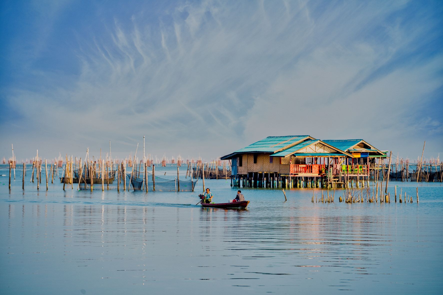
Ko Yo
An island in the middle of the lower Songkhla Lake. Most of the area is hillside and plains along the foothills. Most of the villagers on the island are engaged in fishing in Songkhla Lake. ko Yo is also a famous for raising fishing in cages in Songkhla Lake. On the island, there is a traditional orchard like “Somrom” that means fruit that will take turns to produce fruit throughout the year, e.g., pomelo, coconut, jackfruit, and cempedak, which is the famous fruit of Ko Yo that looks like a jackfruit but smaller. It can be fried like a banana or eaten fresh. There is also the Ko Yo weaving group, which is famous for local fabric with unique patterns, e.g., Ratchawat, Spanish cherry flower, Shorea roxburghii flower, etc. It is also possible to cruise to see the scenery around Ko Yo – see the local fishing methods and enjoy the atmosphere of the lake, especially during sunset. There are many homestays and restaurants on the island.
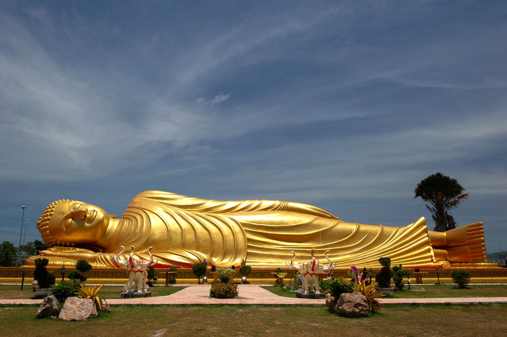
Wat Laem Pho
Located on ko Yo. It was built in 1787 during the reign of King Rama III. In the Temple, there is a large golden Buddha image in the nirvana posture constructed in 1994. It is enshrined outdoors at the foot of the Tinsulanonda Bridge (first period) and is eye-catching to passers-by. The feet of the image have beautiful art patterns on both sides.
There are also important sacred sites of the Temple, e.g., Phra Ubosot, which is art from the early Rattanakosin Era created without bouquets and leaves. There is a gable pattern in front of a three-headed elephant. The back gable is a garuda stopping a Naga. Koei Praithan was used as a residence for the monarch in the past when giving alms to the people during the royal ceremony to make merit. The ancient chedi is to the north of the Ubosot and is made of brick and mortar on a square base. The base of the facade is connected to the stairs leading up to a low platform like a balcony. It is possible to walk around the chedi. In the temple area, there is also a Brahma pavilion, Chao Mae Kuan Yin, and a Buddha image in the attitude of subduing Mara called “Phra Somdej Chao Ko Yo enshrined here.
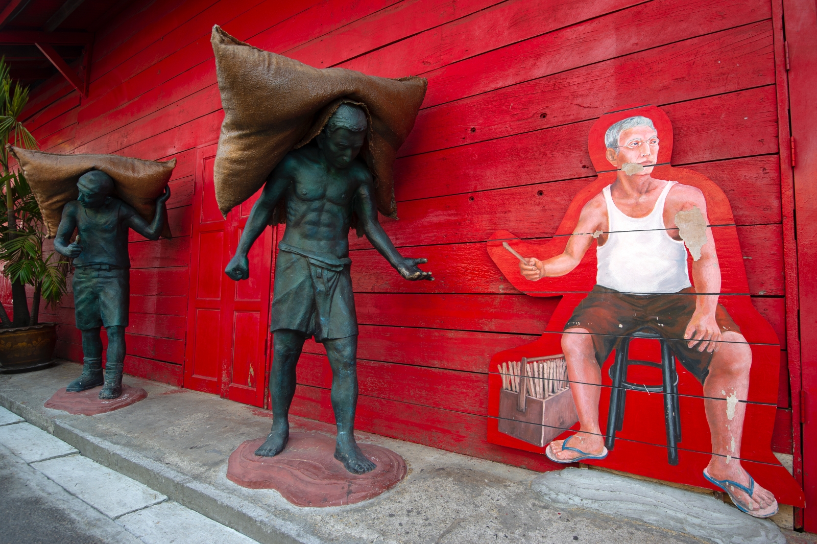
Rhongseedanghubhohin
Before entering Songkhla old town, stop and explore Rhongseedanghubhohin. enjoy colorful street arts and capture some photos at this red mill on Yaring and Raman Road.
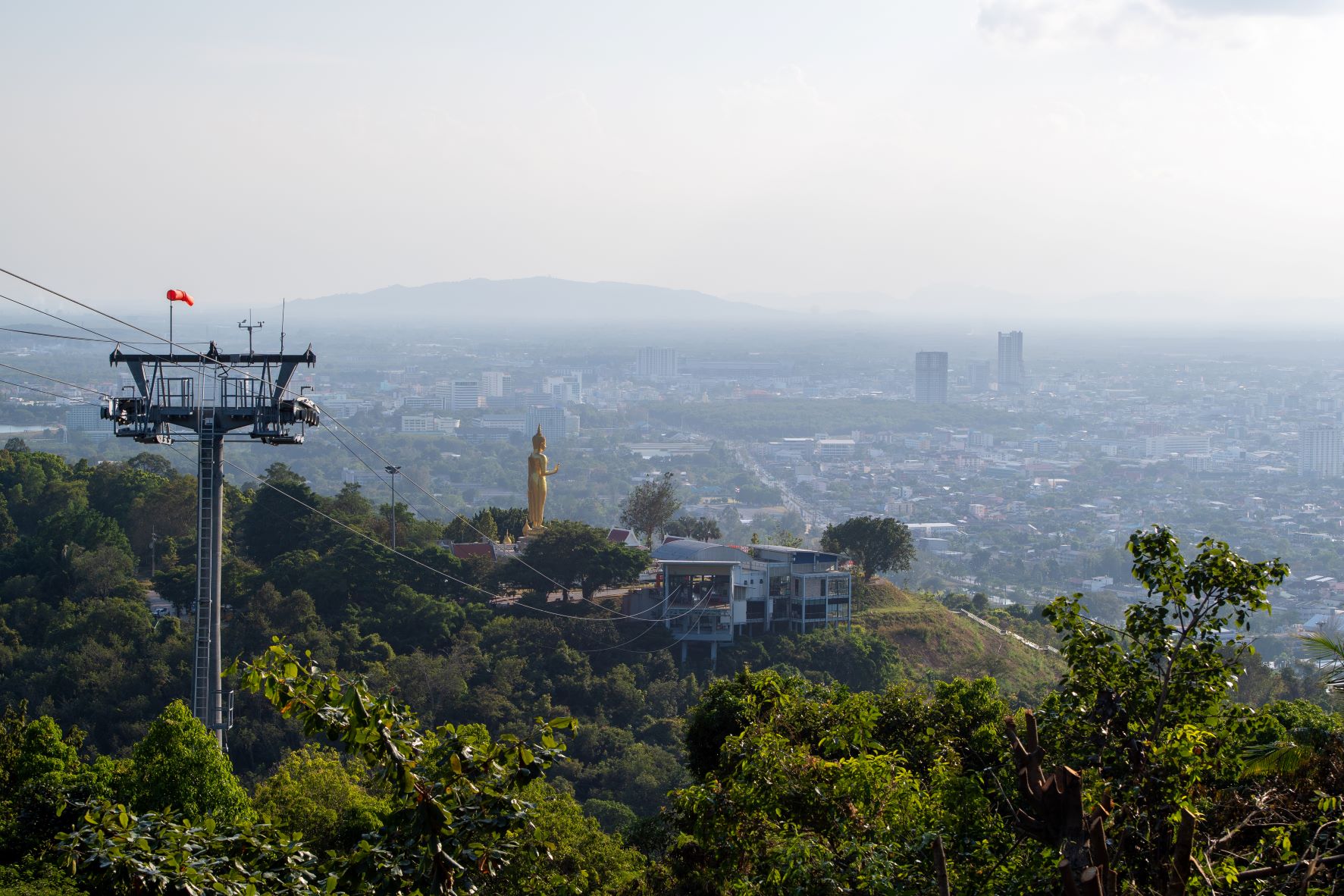
Hatyai
Hat Yai, a district of Songkhla, is perhaps better known than the provincial capital itself. Hat Yai serves as a southern hub of communication, trading and transportation as well as a gateway to Malaysia and Singapore. In light of this, Hat Yai has gained importance as the Driving force of economic growth in the southern region.
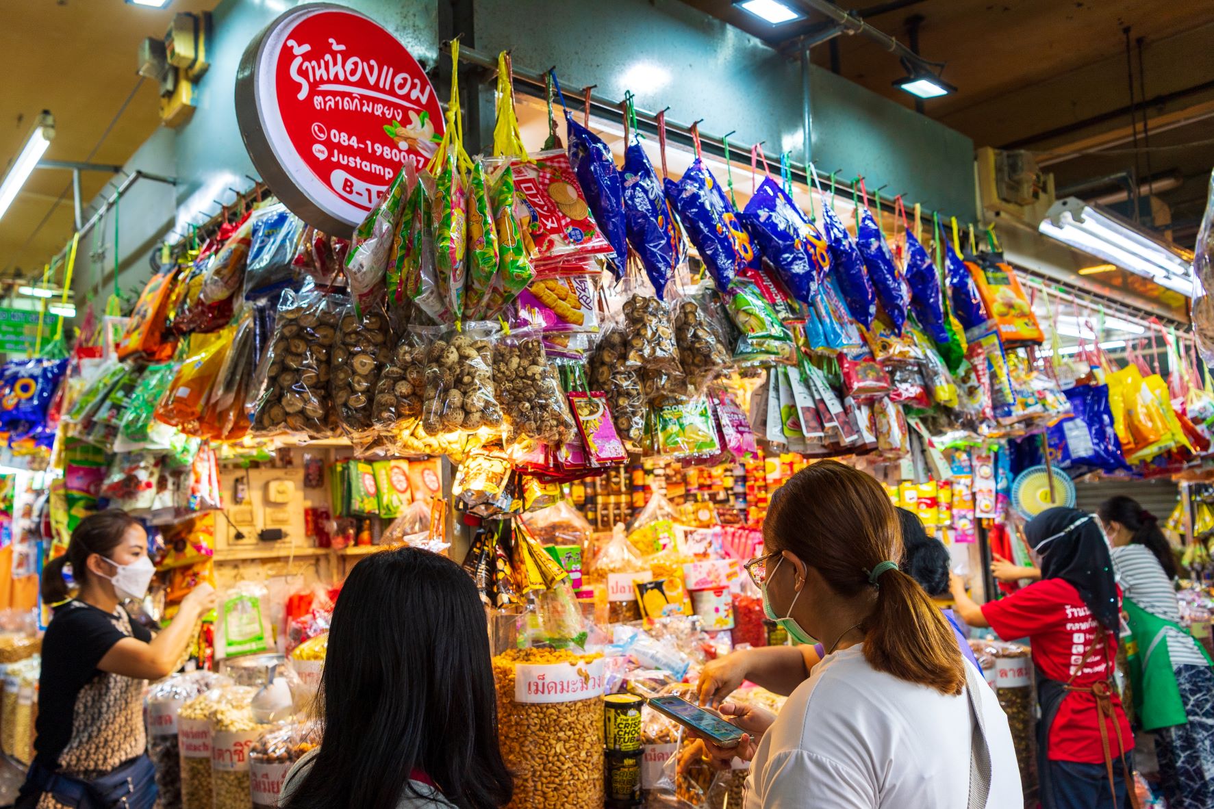
Kim Yong Market
It is a large market in Hat Yai downtown. Many goods are not much expensive such as goods imported from Malaysia.
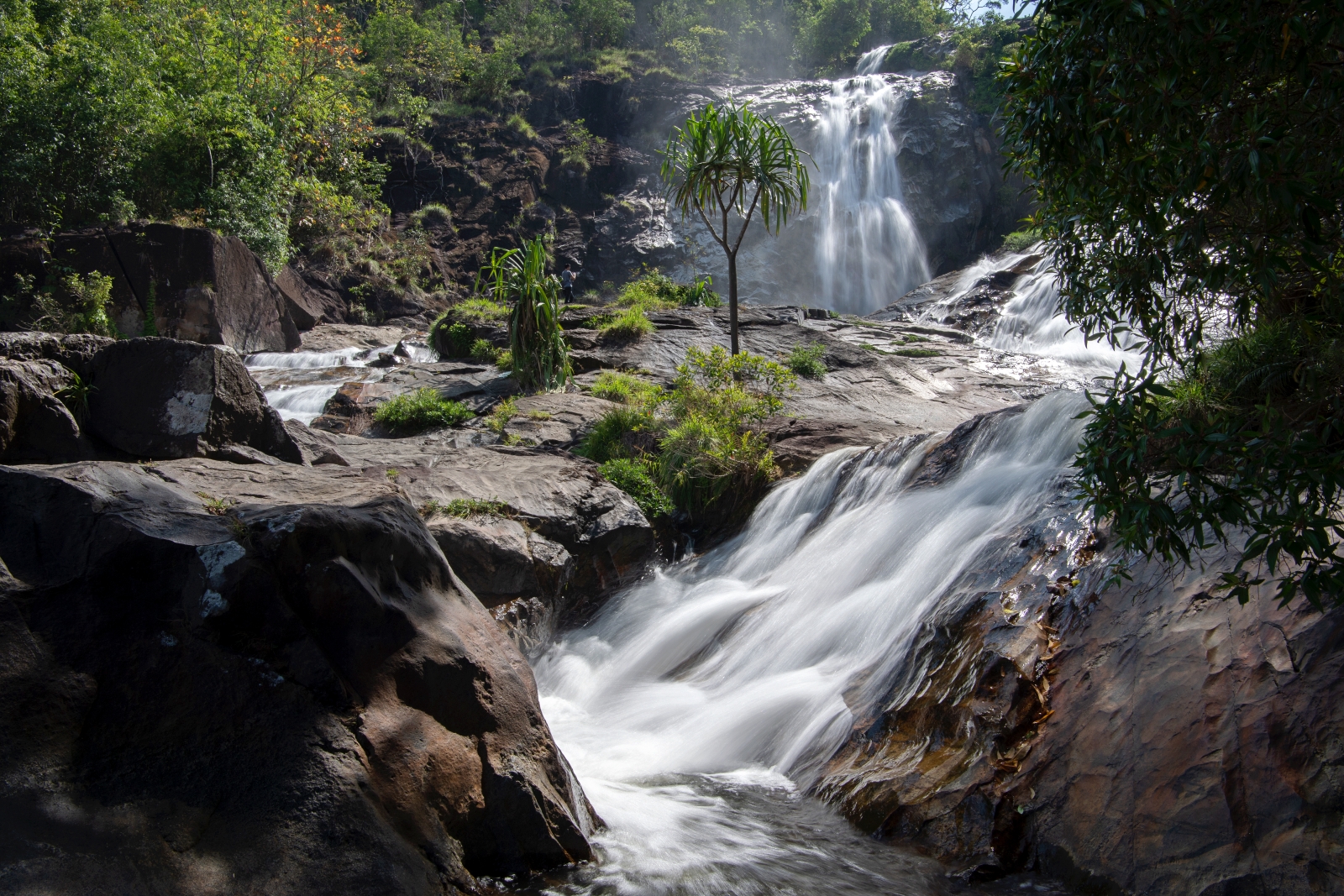
Ton Nga Chang Waterfall
It is one of the most beautiful waterfalls in the southern Thailand and Songkhla province. It has 7 levels. The most beautiful level is the third level called Ton Ngachang as the stream separated into two, resembling a pair of elephant’s tusks. The third level Ton Nga Chang-The most beautiful level. Must not miss. 15min walk from the second level. The route is quite steep. In the pond, there is a big rock at the center. You can see the scenery below by sitting on the rock as this level is high. highGetting thereBy car, from HadYai, Songkhla province, take the Phetkasem Rd. (HadYai-Ratphum), turn left at km.13 to the Ton Nga Chang Wildlife Sanctuary and continue for about 13km. The total distance is 26km.
Hatyai City Park
Hatyai City Park is located on Kanjanavanich Road, Hat Yai District. It is a recreation area of Hat Yai and neighboring districts. Whole mountain area was modified to be a shady park with many trees in an area of 900 rai.